La Viña Dam
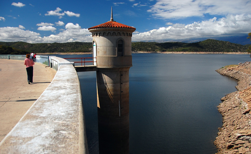
25 kilometers from the City of Nono is La Viña Dam, a magnificent engineering work which astonishes visitors by its astounding dimension.
Visitors can get to this spot whether on a guided tour to the dam, where a guide provides accurate information about the area, or just by car. In both cases, tourists should head off at the City of Nono southeast along the Provincial Route 14. We chose the guided tour and learned that Nono o Ñuño stands for “woman’s breasts” in the Quechua tongue – referring to two mounts which are very much alike. Nono is a town of long naps, deep silence and quarrelsome wines (“rough tasting wines”). This was the first town of Traslasierra Valley and a place where the Comechingones (“indigenous people to the provinces of Cordoba”) could survive longest. The guide talked about the cultural events in the town, especially in the months of January and February. Leaving behind the town, on the right, we saw Nono’s Chico River, which starts at the Achala Hills. Later on, we went past Consultas Stream and San Huberto Neighborhood. On the left, we saw Mount Caolín, where minerals are removed for the manufacture of grease removers; and, afterwards, we crossed the Perchel, which led to the access to Las Rabonas or Las Chupinas District.
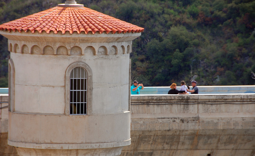
We headed forward along the Provincial Route and, on the left, was the Equestrian School run by Luis Liste, a man who talks to his pregnant mares’ bellies so that foals may, once born, recognize human voices. A firm order, but full of love is enough to make them do what you want. We left San Alberto District and headed into San Javier District. We found Las Totoras Stream, climbed a long and hard slope known as the “cuesta del ciego” (“the blind man slope”) and, from that spot on, we enjoyed the views of Mounts Atenas, Negro, de la Cruz and el Champaquí – the latter is the highest in the Province of Córdoba, standing 2,790 meters above sea level. At that time, we had traveled 19 kilometers. At the roundabout located at De los Pozos Ravine, we turned right in order to travel the last 6 kilometers up to the dam. The lake scene occupies 1,050 hectares and it starts at Los Sauces River. We went down one side of the huge wall of the dam and walked up to the other side as we gazed at the impressive depth of the dam. The guide told us that the dam project had been submitted by Mr. Luis Antonio Medina Allende, who was in charge of Public Works and Utilities Department of the Province of Córdoba in 1938. The following year, the project was verified by engineer Simons and approved by the Hydraulic Department. It was in this year that the dam construction started to be carried out and was completed five years later. The following are some of the main features, which make this dam the biggest of Argentina: the wall is 317 meters long, the base thickness is 25 meters and its crest width is 15 meters. On the water body side, it is 106 meters high and, on the outlet, it is 107 meters high. The dam contains about 3 million cubic meters of concrete, 8 gates of 6 meters by 5 meters each and its maximum water elevation is 102 meters. This power station was opened in 1952. It has two turbines generating 4 million Kwh each. The regulation of Los Sauces River through the storage of water in the dam can hold 90 % of the annual average flow, which is released to irrigate 24,000 hectares of land. The dam also formed a water body, where tourists may enjoy sport activities like pejerrey (silverside) fishing, water motorcycling and kayak practice. The breathtaking beauty of the surrounding landscape, the deep canyon on the one side and the lake with the Achala hills on the other were enough to feel that the journey had been worthwhile. After a few minutes, we went back to the town with one stop at Las Candelarias, where the kind locals offered us foot-pressed red wine, Mistelle, salami and homemade cheese. Visitors can also buy all kind of medicinal and digestive herbs such as peperina, cola de quirquincho – among other herbs.
Marcelo Sola
Eduardo Epifanio
Contact of the excursion or tour
Manito
San Martín 926, Mina Clavero, Córdoba, Agentina
Phone: +54 3544-471371
